Bennapedia Map
Learn more about the points-of-interest on Bennachie by exploring our map below.
Back o' Bennachie Toilets
Shepherds Lodge
Shepherd’s Lodge Colony House (Ruin).
Home to the Littlejohn family before their eviction in 1878, Shepherd’s Lodge consists of the house and range of buildings. The remains of the fields can still be seen and are now the location of a new foraging woodland and kailyard (kitchen garden).
Shepherds Lodge sits between Esson’s old house and the quarry on the south side of the Colony Trail path. It can be easily accessed from a small path which leads down to the ruins of a building with four abutted compartments. Evidence suggests that the two larger compartments were once homes to two families, while the two smaller compartments were possibly a cart shed and storeroom. The buildings face southeast, overlooking the Don Valley and part of the Garioch, with a kailyard (kitchen garden) along the back and to the southwest side. There are associated fields lying to the front of the house and a stone well to the southwest with access back onto the Colony Trail. Under a joint initiative between the Bailies of Bennachie and the University of Aberdeen this site was excavated in 2013. (See report in Bennachie Landscapes Series 3.)
Shepherds Lodge was the home of Alexander Littlejohn for over 40 years. Alexander and his wife, Elizabeth, together with their three youngest children moved to Bennachie in the mid-1830s. While living at Bennachie they had four further children, the first (David) born in 1838, was the second recorded birth on the Colony. As the Littlejohn family grew over the years, a smaller extension was added where one of Alexander’s sons and his family lived. With the Division of the Commonty in 1859, Alexander was given a one-year lease at Shepherds Lodge, which included the standard condition for Colony crofts that tenants must improve a half-acre of ground, within his boundary, each year. The early 1860s were unkind to Alexander as he lost his wife, his daughter, Sarah Mitchell, and her husband, James, leaving five orphaned children. Three of the children were subsequently housed at Shepherds Lodge. By 1878 Alexander was 84 years old, in poor health, unable to work and classed as a pauper by the Poor Board. Then, due to rent arrears, he was evicted. The local story goes that the furniture was removed and Alexander was carried out of his house on his bed, along with crying children and other family members. The walls were then pushed in and the roof set alight. However, following the 2013 excavation the story of the roof being set alight is in question. (See report in Bennachie Landscapes Series 3.) Alexander died a year later in Aberdeen.
Today, visitors to Shepherds Lodge can view part of the original kailyard which has been recreated by the Bailies and members of the local community. The different types of fruit growing there are mostly varieties that would have been available in the 1800s and are being cultivated under similar methods to those of the Colonists. In 2017 the fields in front of Shepherds Lodge (once part of the Littlejohn croft) were planted with native trees and shrubs that will eventually bear fruits.
For more information see https://www.bailiesofbennachie.co.uk/what-happened-to-the-bennachie-colonists
Bennachie Colony App: https://www.bailiesofbennachie.co.uk/bennachie-colony-trail-app
Map Reference: NJ 690 218
Coordinates: (57.285762,-2.5158842)
Cairn Couttie
Cairn Couttie Colony House (Ruin).
Remains of a small house, the walls have consolidated with lime mortar. Located within the west gable is the built-in fireplace.
Following an excavation of Cairn Couttie in 1999, archaeologists found the house walls had been carefully constructed and the courses mortared. The house consisted of one room, measuring approximately 8 x 5 m, and a fireplace (with peat still visible) in the west gable wall. The house has a doorway towards the east end and a window towards the west. Among the finds were numerous shards of window glass, glass bottles, pottery, remnants of two shoes, and a metal belt buckle. There is a possible kailyard enclosure to the west of the house and associated enclosures to the north and south.
The 1851 Census shows that Mary Emslie, and her two children, Margaret Robb and Robert Addison (or Eddsion/Edeson) lived there, along with two boarders, Alexander (Sandy) and Mary Lindsay. By 1861 the Emslie family had left the Colony.
Sandy Lindsay was a fish dealer who drove fish from Peterhead and Aberdeen, specialising in herring (fresh and salt) and dried dogfish. From 1855 the Lindsay’s were afflicted by poor health and employment problems due to seasonal interruptions to the supply of fish. As a result, they subsequently relied on relief from the Oyne Parochial Board. Their livelihood was further severely impacted with the death of their horse in 1857. In November 1860, the house was deemed uninhabitable and the couple were moved to another house on the Commonty.
The name “Cairn Couttie” has many variants including Cairn Coutty – Cooly – Coolie – Cootie. The “Coutie” or “Cooly” elements both derive from the Gaelic “coille” – a wood, or perhaps “coll” – hazel. As there is no evidence for any name of the croft, it seems reasonable to adopt “Cairn Couttie” as a working name.
For more information see https://www.bailiesofbennachie.co.uk/what-happened-to-the-bennachie-colonists
Bennachie Colony App: https://www.bailiesofbennachie.co.uk/bennachie-colony-trail-app
Map Reference: NJ 692 217
Coordinates: (57.284878,-2.5125542)
Essons Croft
Essons Croft (Boghead of Tullos) Colony House (Ruin).
Boghead of Tullos (sometimes referred to as Esson’s Croft) is the area of small fields surrounding a ruined cottage, barn and byre, which can be viewed from The Colony Trail looking northwest across the stone dyked fields with Mither Tap in the background.
This was one of the homes of the Esson family. Archival research confirms that the Esson family were living on Bennachie around the mid-1840s and by 1851 there were three Esson families living there. In 1847 John Esson married Sarah Findlater, the daughter of James and Ann Findlater, one of the first settlers of the Colony. John and Sarah lived at Boghead of Tullos for the whole of their married life and raised six children. The youngest, George, was the last of the Colonists, living most of his life on the croft and died there in 1939. His memorial gravestone is nearby in Chapel of Garioch and bears the words “Descended from the first and himself the last of the colonists of Bennachie”. It is not certain where in the Colony the other two Esson families lived, although research suggests that the croft close to Shepherds Lodge could be a possibility. For working purposes, this is now referred to as “Esson’s Old House”.
The Esson family were well-known for their ability to build drystone dykes and some of their hard work can still be seen around the hill today. Boghead of Tullos is now in private ownership.
For more information see https://www.bailiesofbennachie.co.uk/what-happened-to-the-bennachie-colonists.html
Bennachie Colony App: https://www.bailiesofbennachie.co.uk/bennachie-colony-trail-app.html
Map Reference: NJ 693 219
Coordinates: (57.286681,-2.5109204)
Bede House
Bede House. Remains of Bede House (Hostelry/Hospital).
Remains of building partly hidden under plantation trees known locally as the Bede House.
A “Bede House” was a hostelry/hospital of medieval origin for displaced men built and served by a religious house or landowner. The Bennachie Bede House lies 500 m to the southwest of Pittodrie House (now a hotel) alongside a turnpike road at a junction with an older road that used to skirt Bennachie to the East and South.
Map Reference: NJ 693 235
Coordinates: (57.301053,-2.5111197)
Hosie’s Well
Hosie’s Well, said to run with Hosie’s tears!
Situated beside the Rowan Tree footpath and used for generations as a resting and picnic spot on the way up to Mither Tap, Hosie’s Well sits also beside the Maiden Causeway.
The Battle of Harlaw took place in 1411 on the sloping land to the west of Inverurie. Here the Earl of Mar and his men fought the Highlanders in a bloody battle. Hosie, a local man, was on his way to marry his bride when he was persuaded to fight in the battle instead, postponing his wedding. After the battle, he was imprisoned in a Hebridean dungeon for several years. Eventually he escaped and went to find his bride to be. While he was in prison she had married someone else.
Hosie was heartbroken, and with nothing to live for, he died and was buried on the hill overlooking Mither Tap. The well near where he was buried is called “Hosie’s Well” because it was believed that the water in the well is “nothing but Hosie’s tears”.
Although it must be said McConnachie (Bennachie p50) appears to be unaware of him “who Hosie was has not been handed down by tradition, nothing but the name and the well remain”. What he does say though is “That some fifty years ago one William Gilmore built himself a hut there, the remains of which are still visible, close to the well, and lived in it with his family for about two years”. It does seem strange that McConnachie with his vast knowledge of Bennachie is totally oblivious to the Hosie legend.
The enigma is that on p79 he included the ballad of Hosie’s Well which he must have read. Curious!
Although Hosie is a Scots name ; Hose or House with the diminutive -ie: ending (Scottish Names, Waverley Books) this could be an alternative name from William Gilmore’s “hut”.
Map Reference: NJ 68108 23169
Coordinates: (57.298000,-2.530856)
Paths Suitable for Wheelchairs
Bennachie Visitor Centre - Discovery Trail - ½ mile (1km) allow 30 minutes.
A gentle wander through the forest. Wildlife rubbing posts are dotted along the trail; collect paper and crayons from the visitor centre. A smooth firm trail, with short gentle slopes and no obstacle, note a wee section going up to towards the pond has water channels.
Map Reference: NJ 698 216
Coordinates: 57.284019, -2.5025896
Disabled Toilet Facilities (Bennachie Visitor Centre)
Bennachie Visitor Centre, Back o’ Bennachie and Rowantree (need Radar key).
Map Reference: NJ 698 216
Coordinates: 57.284019, -2.5025896
Turnpike Trail
Turnpike Trail (T), Bennachie Centre, AB51 5HX.
The Turnpike Trail is a pleasant 4 mile (6.4 km) link between the Bennachie Centre and Rowantree car parks. You follow an old turnpike route through Pittodrie estate woodlands and over the Rushmill Burn. The route is not well-marked from the Rowantree end so taking a map is recommended.
Map Reference: NJ 698 216
Coordinates: (57.284019,-2.5025896)
Gordon Way Trail
Gordon Way Trail (G), Bennachie Centre, AB51 5HX.
The Gordon Way starts at the Bennachie Centre and runs for 11.5 miles (18.5 km) along the southern side of Bennachie and on to the Suie car park, 3 miles south east of Rhynie. You walk through forests, farmland and open moorland, stout boots are recommended as some sections are muddy.
Gordon Way Trail not well maintained or well signposted.
See https://www.ldwa.org.uk/ldp/members/show_path.php?path_name=Gordon+Way
Map Reference: NJ 698 216
Coordinates: (57.284019,-2.5025896)
Disabled Toilet Facilities (Rowantree)
Disabled Toilet Facilities (Back o’ Bennachie)
Bennachie Visitor Centre, Back o’ Bennachie and Rowantree (need Radar key).
Map Reference: NJ 661 246
Coordinates: 57.310706, -2.564373
Craigshannoch
Craigshannoch means “hill of the foxes”. This is an interesting top with a rocky summit and a line of cliffs descending to the north in what is almost an arête Here there is some fine rock scenery. About half way down the rocky “arête” is Harthill’s Cave. It was here that the notorious Leith, laird of Harthill, hid as he watched his Castle burn having set fire to it to spite his creditors. The entrance is low but inside a number of people could be accommodated in deteriorating weather conditions.
Map Reference: NJ 672 232
Coordinates: (57.298211,-2.5459282)
Discovery Trail
Discovery Trail (Black) at the Bennachie Centre, AB51 5HX.
Easy ½ mile / 1 km Allow ½hr. A gentle wander through the forest. Wildlife rubbing posts are dotted along the trail; collect paper and crayons from the visitor centre. A smooth firm trail, with short gentle slopes and no obstacles, suitable for wheelchair users
Map Reference: NJ 698 216
Coordinates: (57.284019,-2.5025896)
Shepherd’s Lodge Kailyard
Kailyard Reconstructed Colonist Garden
In 2017 the Bailies were awarded a grant from the HLF to help fund a community project to recreate part of a Kailyard at one of the old Colony sites known as Shepherds Lodge, once the home of the Littlejohn family. The aim of the project was to help discover what life might have been like for the Colonists. What were their methods of farming, were they influenced by the “improvements”, what did they grow, and what problems may they have encountered? Following research our cultivation methods are similar to those we believe would have been used by the Colonists and the chosen plants are mostly heritage fruit bushes from the 19th century.
Map Reference: NJ 690 218
Coordinates: (57.285762,-2.5158842)
Mither Tap Timeline Trail
Mither Tap Timeline Trail (Green), Bennachie Centre, AB51 5HX.
Strenuous 3¾ miles / 6 km Allow 2¾ hrs. Climb to the rocky, granite summit of Mither Tap for superb views and to explore the impressive Pictish fort. A very steep, rough trail with roots, rough rock steps and drains. Narrow in places. The summit is slab rock and can be slippery when wet.
Map Reference: NJ 698 216
Coordinates: (57.284019,-2.5025896)
Colony Trail
Colony Trail (Orange) at the Bennachie Centre, AB51 5HX.
Moderate 2½ miles / 4 km Allow 1¼ hr. An easy-going trail winding through attractive open woodland and the ruined houses and fields of the Bennachie colonists. Firm and generally smooth, with some uneven areas. Generally moderate slopes, with some short fairly steep parts. Includes steps, roots and rocky areas.
Map Reference: NJ 698 216
Coordinates: (57.284019,-2.5025896)
Mither Tap Heather Brig Trail
Mither Tap Heather Brig Trail (Pink), Donview, AB51 7JE.
Strenuous 6 miles / 9.6 km Allow 4 hour. This grand, adventurous route crosses Millstone Hill and on to the landmark of the Mither Tap. Stunning views. Very steep, rough and rocky trail, with large steps and roots. Generally narrow, and has a narrow timber walkway. Can be muddy.
Map Reference: NJ 672 189
Coordinates: (57.259587,-2.545357)
Mither Tap Maiden Causeway Trail
Mither Tap Maiden Causeway Trail (Purple) NJ 692 244 Rowantree AB51 5HZ.
Strenuous 3½ miles / 5.6 km Allow 2 ½ hours.
A walk of legends to the impressive Pictish hill fort. The Maiden Causeway itself is named after a local girl who bet the devil that she could bake a batch of oatcakes before he could build a road up Bennachie.
Steep, rough and uneven rocky trail with steep rock steps. Some parts are narrow and can be wet and muddy after rain.
Map Reference: NJ 692 244
Coordinates: (57.309130,-2.5128917)
Millstone Hill Trail
Millstone Hill Trail (Blue), Donview, AB51 7JE,
Strenuous 3½ miles / 5.6 kms Allow 2½ hr Walk up through woodland onto a heather clad hill, lovely view of Mither tap from the top. A very steep, rough and rocky trail, with large steps and roots. Generally narrow, and has a narrow timber walkway. Can be wet and muddy
Map Reference: NJ 672 189
Coordinates: (57.259587,-2.545357)
Mither Tap Quarry Trail
Mither Tap Quarry Trail (Brown), Back O’ Bennachie, AB52 6RH.
Strenuous 5½ miles / 9 km Allow 3¾ hours. A good walk on the hill, visiting Mither Tap and Bennachie’s highest summit Oxen Craig.
A very steep, rough trail with long climbs, large steps, rocky and some areas on the summits which may be muddy.
Map Reference: NJ 661 245
Coordinates: (57.309808,-2.5643595)
Larick Trail
Larick Trail (Yellow), Back o’ Bennachie, AB52 6RH.
Strenuous 1½ miles / 2.4 km Allow 1 hour. The Larick (Larch) Trail Green in spring, lovely golds in Autumn.
A moderate to fairly steep trail, with varied surfaces: firm forest roads, earthy paths that can be muddy and rough sections with rocks, roots and large steps.
Map Reference: NJ 660 242
Coordinates: (57.307106,-2.565978)
Bennachie Visitor Centre Toilets
Rowantree Car Park Toilets
Donview Car Park
Donview Car Park, AB51 7JE.
No Toilets.
Parking Fee Applies.
Also see https://forestryandland.gov.scot/visit/donview for more details.
Map Reference: NJ 672 189
Coordinates: 57.259587, -2.5453565
Bennachie Visitor Centre Car Park
Bennachie Visitor Centre, AB51 5HY.
Centre open April to end October, Parking Fee Applies. If you are coming to the Bennachie Visitor Centre for the first time and are using a Sat Nav - please be aware that your device may direct you up private roads at the start of the post code. Please continue along the road until you see our entrance sign. Thank you.
Toilets, Disabled access, Winter opening Fri, Sat, Sun, 10am-3pm.
Tel: 01467 681470.
Also see https://www.bennachievisitorcentre.org.uk/ and https://forestryandland.gov.scot/visit/bennachie-visitor-centre for more details.
E-mail bennachie.warden@aberdeenshire.gov.uk
Map Reference: NJ 698 216
Coordinates: 57.284019, -2.5025896
Rowantree Car Park
Rowantree Car Park, AB51 5HZ.
Car park run by Aberdeenshire Council, No Parking Fee.
Toilets open April to end of September, Disabled Toilet (need Radar key).
Toilets cleaned by Bailies of Bennachie volunteers.
Map Reference: NJ 692 244
Coordinates: 57.309130, -2.5128917
Back o’ Bennachie Car Park
Back o’ Bennachie Car Park, AB52 6RH.
Toilets open April to end of September.
Disabled Toilet available.
Parking Fee Applies.
Also see https://forestryandland.gov.scot/visit/back-o-bennachie for more details.
Map Reference: NJ 661 245
Coordinates: 57.309808, -2.5643595
Tilliefoure Wood
Beautiful and ancient woodland, present since 1750.
Note at Donview Forestry and Land Scotland are slowly to extending the oak woodland at Tilliefoure.
Map Reference: NJ 665 192
Coordinates: (57.262231,-2.5570003)
Paradise Wood
Beautiful and ancient woodland, present since 1750.
Map Reference: NJ 677 177
Coordinates: (57.248844,-2.5369118)
Black Hill
Black hill is the most westerly point of the Bennachie range.
This is the most westerly point of the Bennachie range. On its summit is an O.S. Trig Point, one of two on the hill, the other being on the Mither Tap. Both, now redundant are being maintained by the Bailies of Bennachie. From the top a ridge descends SSW for over 1Km to a smaller unnamed top (363m) conspicuous from below because of a small plantation of larch trees. This part of the hill is owned by Castle Forbes Estate. The late Lottie Marr of the Mill of Tilliefoure was in no doubt that they had been planted on the birth of the 22nd Lord Forbes so that when his 21st birthday was being celebrated there would be an abundant supply of wood for a massive bonfire visible from miles around. However when Lord Forbes was 21 he was away serving King and Country in the Second World War so the trees remain. At the time of writing, his Lordship, long time Guardian of Bennachie and in his nineties, had no knowledge of Mrs Marr’s theory.
Map Reference: NJ 635 219 Height: 433 m
Coordinates: (57.286253,-2.6071300)
Hummel Craig
This is the name given to the 1km (approx) northern spur of Watch Craig. The word “hummel” is used in various connotations e.g. “hummel doddies” are gloves without fingers, a hummel stag is a stag without antlers so Hummel Craig presumably is so named as it has no outstanding features.
Map Reference: NJ 656 235
Coordinates: (57.300788,-2.5725191)
Averon Knap or Moss Grieve
Averon Knap also known as Moss Grieve.
This is scarcely a top but rather an elevated mound some 0.5 km east of Oxen Craig. It is close to an area of deep peat and in the days of the peat cutters it would have been regarded as a sort of grieve (“gaffer”) looking down on them. The other name refers to the fact that averons (cloudberries) are present because of the deep peat and altitude. These are plants with strawberry-type leaves and flowers and fruits like large raspberries which are orange when ripe. They should not be eaten raw but do make a lovely jelly.
Map Reference: NJ 666 226 Height: 475 m
Coordinates: (57.292778,-2.5558028)
Hermit Seat
In “Bennachie” by Alex Inkson McConnochie 1890 it is said that a “hermit” used to frequent this part of the hill.
Map Reference: NJ 644 229 Height: 478 m
Coordinates: (57.295306,-2.5923455)
Harthill Cave
About half way down the rocky “arête” on Craigshannoch is Harthill’s Cave. It was here that the notorious Leith, laird of Harthill, hid as he watched his Castle burn having set fire to it to spite his creditors. The entrance is low but inside a number of people could be accommodated in deteriorating weather conditions.
Map Reference: NJ 672 233
Coordinates: (57.299110,-2.5459415)
Little John’s Length
Where Jock o’ Bennachie slept on Bennachie!
This is the area between two small tors (NJ 678 234 and NJ 679 235) to the east of Craigshannoch and with a distance of 200m between them. According to legend it is the bed of the giant Jock o’ Bennachie.
Map Reference: NJ 678 234
Coordinates: (57.300051,-2.5359984)
Gouk Stane
The Bennachie Colonists believed that when a cuckoo returns to Bennachie in the spring it perched on this stone to proclaim its arrival. Adults arrive in late March or April and depart in July or August, with young birds leaving a month or so later. In the wall beside it look for the hatching cuckoo egg and try to decipher the inscription. The cuckoo (Gouk) is used as the symbol at the Bennachie Centre. This large stone is next to the ruins of a colony house and was a Commonty boundary stone.
Map Reference: NJ 693 217
Coordinates: (57.284884,-2.5108955)
Boundary Stones
On Bennachie there are several boundary stones that mark the Division of the Comonity of Bennachie in 1859. Bennachie was divided up by nine neighbouring lairds and these boundary stones mark the limit of their land ownership.
On Bennachie there are at least 27 boundary stones that mark the Division of the Commonty of Bennachie in 1859.
For more information see https://canmore.org.uk/search/site?SIMPLE_KEYWORD=bennachie&SITETYPE=1469
Map Reference: NJ 692 215
Coordinates: (57.283081,-2.5125292)
Little Oxen Craig Quarry
Little Oxen Craig Quarry, 425 m, Granite Lintel Quarry.
Little Oxen Craig Quarry was opened by Andrew Fordyce in the mid 1800s and operated as a granite lintel quarry for 40 years. In August 1891 quarrying stopped overnight when floods washed away some of the access routes to the quarry. The lovely granite lintels are still there.
Map Reference: NJ 663 232 Height: 425 m
Coordinates: (57.298146,-2.5608620)
Hillside
Hillside Colony House (Ruin).
Hillside is set back from the footpath and is situated on an elevated site above the Clachie Burn. The croft consists of two houses, separated by a cobbled area, and several small outbuildings, with surrounding fields of over 7 acres, making it the largest of the colony crofts. The house to the west is the smaller of the two dwellings and originally consisted of one room, while the house to the east had 2 rooms and a kailyard attached. Under a joint initiative between the Bailies of Bennachie and the University of Aberdeen this site was excavated in 2013. (See report in Bennachie Landscapes Series 3.) Over the years, trees and shrubs have grown freely in this area making access difficult.
It is not known when the dwellings were built or by whom, but it is possible that Hillside was, for part of its time, a shared occupancy croft. Research shows that one of these houses could have been the home of Francis Cooper and his wife, Isobel Smith. It is believed that the Cooper family first arrived on Bennachie in the late 1830s with their son, William. While on Bennachie they had three further children, Francis jnr., who was the first recorded birth on the Hill of Bennachie in 1838, followed by James (1841) and Arthur (1843). Sadly, Francis Snr died during the mid-1840s leaving Isobel with four young sons to bring up.
During the 1850s the smaller house was occupied by the Mitchell family. In 1849 James Mitchell married Sarah Littlejohn (daughter of Alexander Littlejohn at Shepherds Lodge). He came to live on Bennachie bringing his young son, Alex, from a previous marriage. By 1862 James and Sarah had five young children when sadly Sara died, followed a year later by James, thus leaving a family of five children aged between 13 and 2 years.
The larger house was occupied by John McDonald and his daughter, Margaret. The date of their arrival is believed to be some time in the 1850s. Archives show that in 1859 John took a lease on the property and continued living there until his death in 1870. After his death, Margaret carried on at the croft but fell behind with the rent and records show that she was “removed” in 1878. A year later she died in Aberdeen City Hospital of pneumonia.
For more information see https://www.bailiesofbennachie.co.uk/what-happened-to-the-bennachie-colonists
Bennachie Colony App: https://www.bailiesofbennachie.co.uk/bennachie-colony-trail-app
Map Reference: NJ 691 215
Coordinates: (57.283074,-2.5141879)
Watch Craig
It is unknown why it is called Watch Craig. There are good views from this top of the Don valley. At the rocky top carved into the bedrock are the letters A, A, P standing for Ardoyne, Auchindoir and Premnay referring to the land allocation to the three estates on the division of the commonty of Bennachie.
Map Reference: NJ 653 224 Height: 495 m
Coordinates: (57.290885,-2.5773425)
Burnside
Burnside Colony House.
Burnside is on an elevated site, overlooking the Clachie Burn and can be viewed from the footpath along both its south and west borders. As well as the remaining house walls, the associated fields and kailyard have some surviving sections of drystone dyke boundaries. In 2013, excavations and soil testing revealed drainage ditches in the fields, topsoil that had been ploughed and a kailyard that had been improved by turves. This all helps to illustrate the hard work of the Colonist in cultivating this stony, poorly drained land with thin, infertile topsoil.
The first known residents of Burnside were James Findlater (an agricultural labourer) and his family who came from Bograxie on the Balquhain Estate in the mid 1830s. It is not known if the Findlater’s were the first residence of the Burnside croft or the exact date of their arrival. The 1841 census shows the household comprised James, his wife Ann (nee Ross), their daughter Sarah, and son Robert. Their eldest daughter, Susanna (a house servant), is not mentioned on the census so is presumed to be away in service. Some time later during the 1840s Ann died and in 1847 Sarah married Bennachie crofter, John Esson, and moved to Boghead of Tullos. In 1851 Susanna is now listed on the census as living at Burnside with her father and two step brothers. After Ann’s death, James had a relationship with Bennachie crofter, widow Isobel Cooper (nee Smith), and the couple had another three children together. In 1854 James died leaving no means of support for the three young children. The Parochial Board agreed to support them at the rate of 7/- (35p) per week.
Susanna’s sister, Sarah Esson, died in 1880 and in the 1881 census Susanna is listed as living at Boghead of Tullos as housekeeper to her brother-in-law, John, and nephew, George Esson. (By this time Boghead of Tullos was the only occupied house in the Colony.) However, the Valuation Roll of 1885 shows Susanna still paid rent of £1 annually for the house and yard at Burnside. By the time of her death in 1889, Susanna was living in Monymusk.
For more information see https://www.bailiesofbennachie.co.uk/what-happened-to-the-bennachie-colonists
Bennachie Colony App: https://www.bailiesofbennachie.co.uk/bennachie-colony-trail-app
Map Reference: NJ 689 215
Coordinates: (57.283061,-2.5175051)
West End
West End Colony House, Remains of a Croft.
West End is the western-most and highest of the Colony crofts (720 ft above sea level) and consisted of around 9 acres. The remains of the croft, as depicted on the 1st Ordnance survey map, shows two buildings, one of a long range divided into two compartments. The home has some skilful stonework in the NE corner suggestive of a cruck-frame support or brace. It had a small enclosure to the N.E, probably a kailyard. There are suggestions of further structures below the house. The associated fields are now under plantation woodland with some areas of natural regeneration.
It was the home of John Garden and his family for around 25 years. John was a stonemason, originally from Forgue, and arrived on Bennachie in the late 1840s with his wife Jane, originally from Inveravon on Speyside, and their three children, Margaret, John and William. While living on Bennachie they had another three children, James, Jean and Elspet, and for a while also boarded a young child, Alex. Ritchie.
On Division of the Commonty, John was forced to pay an annual rent of £1 5s. 0d. (£1.25) for his croft. The 1860s were a wretched time for Jane. Her son, William, died in 1863, aged 15. Then her husband died 1864, in Dufftown, in dire circumstances. Finally, her youngest daughter, Elspet, died in 1865. By this time only her daughter Jean was dependant on her. Jane did not apply to the poor board for help. It is assumed that her eldest son, John, quarrier and blacksmith, still living at home, was probably helping to support them. In 1869, John Jr, through a liaison with Mary Littlejohn (daughter of Alexander Littlejohn, Shepherds Lodge) provided Jane with a granddaughter. John and Mary never married, but Jane took the child in and brought her up. She was named Elspet and may have been named after Jane’s youngest daughter who died a few years earlier. About 1873 Jane moved away from Bennachie and went to Old Machar, Aberdeen, taking Elspet with her. In the 1881 census she is listed as a Housekeeper of a Wash House and Elspet as a scholar.
For more information see https://www.bailiesofbennachie.co.uk/what-happened-to-the-bennachie-colonists
Bennachie Colony App: https://www.bailiesofbennachie.co.uk/bennachie-colony-trail-app
Map Reference: NJ 686 216
Coordinates: (57.283938,-2.5224938)
Esson’s Old House
Esson’s Old House Colony House (Ruin).
The original name of this croft is unknown, and nothing is certain of its history or occupants. However, research suggests that this could be the old Esson house which was later modified into two pauper houses. In more recent times it was referred to as the “A-Frame”, due to an outdoor artwork installed on the site (since removed for safety reasons), but this was purely a working name. The house is difficult to see from the Colony Trail footpath but there is an “ancient monument” sign protecting the site which is clearly visible, and the house is a little way to the left of this. The dwelling still has surviving walls and remnants of a central, stone-built dividing wall which is not tied into the structural walls against which it abuts. This, together with front doorways leading into each of the two halves, suggests later modifications.
According to the Oyne Parochial Board records of 1860 two families (Christie and Cooper) were moved into a house that had until recently been occupied by the Esson family. The Board reported that they had divided and rethatched the house. The Christie family was headed up by John Christie, an Agricultural Labourer. His wife, Mary Reid, together with the younger members of their family moved into one half of this house. Both John and Mary continued living there until they died – Mary in 1864 and John in 1878. The other half of the house was allocated to Isobel Cooper, a widow with a young family to support. Before the year was out Oyne Parochial Board moved them again, this time to the Poor Cottages at Rye Hill. By this time Cairn Coutie had been deemed uninhabitable, so the Board moved Alexander (Sandy) and Mary Lindsay into Isobel Cooper’s vacated part of the house. Sadly 3 years later, whilst still living on Bennachie, Mary Lindsey died. Her husband, Sandy, died in 1875.
For more information see https://www.bailiesofbennachie.co.uk/what-happened-to-the-bennachie-colonists
Bennachie Colony App: https://www.bailiesofbennachie.co.uk/bennachie-colony-trail-app
Map Reference: NJ 690 219
Coordinates: (57.286660,-2.5158968)
Maiden Castle
Maiden Castle, Pictish Fort.
Close to the Rowan Tree Car Park, is a Pictish fort standing on a rocky outcrop surrounded by a ditch and a circle of mature trees. Excavations at the site have confirmed settlement in the area from 7,000BC up to mediaeval times. During excavations in 2009 a rare Iron Age cobbled road, a stone pendant, and a 1,000-year-old sparkling glass bead were discovered. It would have provided early inhabitants with a panoramic view of the Garioch, the neighbouring ancient hilltop forts on Mither Tap and Dunnydeer, and the Glens of Foudland, gateway to the Highlands. Maiden Castle was a very high-status residence, probably home to an ancient prince or king. There are only three or four sites like this in Aberdeenshire. The excavations have now been filled in to preserve the site
For more information see https://canmore.org.uk/site/18182/maiden-castle
Map Reference: NJ 694 244
Coordinates: (57.309144,-2.5095721)
Air Crash Memorial Cairn
Air Crash Memorial Cairn. There have been two air crashes on Bennachie - in 1939 and in 1952.
On 3 September 1939 a Westland Wallace biplane, piloted by Pilot Officer Ellard Cummings with Leading Aircraftman Ronald Stewart as gunner, crashed on the South-East side of Bruntwood Tap.
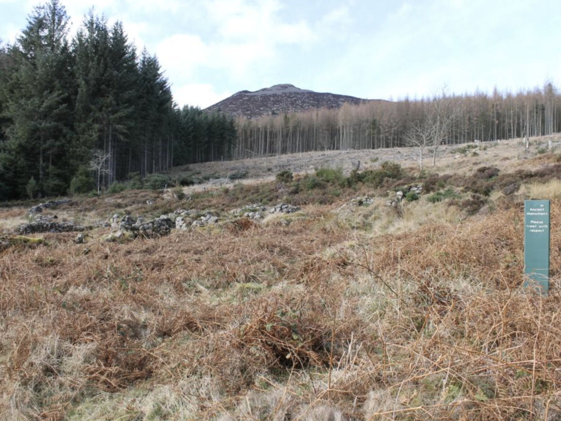
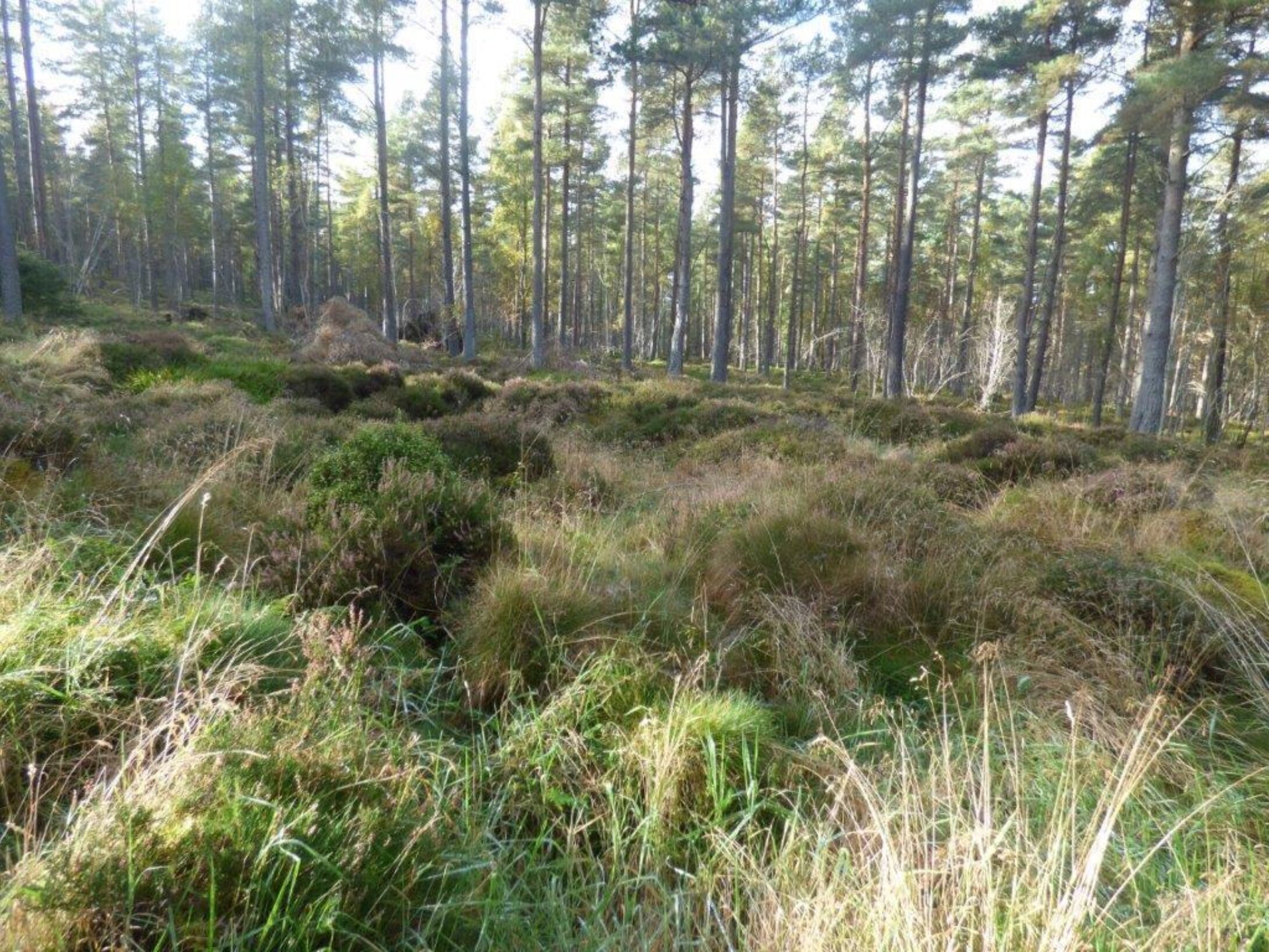
The plane was a Wallace Mk II target tugplane, serial number K6028, on charge to No. 9 Air Observer School (AOS) at RAF Penhros, North Wales, formed to train observers in navigation, bomb aiming, photography and gunnery. It was on a ferry flight from 1 AOS at RAF Wigtown, which had just been disbanded, to 9 AOS. It was flying from Wigtown to RAF Evanton, Easter Ross. It was on the Dyce- Evanton leg, on the correct route but flying too low to clear the hill which was shrouded in mist. Ellard and Ronald died in the crash. They are officially recognised as the first military casualties of World War II. Wreckage of the Wallace is still there but must be left as a memorial to these brave young men.
The cause of the crash was attributed to the poor visibility prevailing at the time. Time of deaths was given as 3pm but his niece, Helen, has Ronald’s watch which stopped at 3.10pm.
Ellard Alexander Cummings, Service No. 40803, the son of James Victor Cummings and Edith Fanny Ellard, was born in Ottawa, Ontario, Canada, on 14 February, 1916 He was the oldest of a family of six, his brothers being James, Donald, Kenneth and John and sister Myrle. His brother Kenneth, Royal Canadian Air Force, died when he was shot down over Leipzig, Germany, in 1944. Brothers Donald and Clayton served in WW II in Canada.He had a wonderful childhood growing up in Ottawa and spending his summers at the Cummings cottage on the Ottawa River. He was a handsome and charming lad, always smiling and all the ladies loved him. He loved music, playing the banjo, mandolin, trombone and piano, winning musical awards along the way. Other passions were sports, his motorcycle and the family car. He liked to drive as fast as possible! Perhaps that is why he made the decision to become a pilot. He was chosen by the British Government for flight training in the RAF. What the qualifications were, what process Ellard would have had to follow is unknown. In 1938 he signed up for the RAF. Along with a small number of other selected Canadians he sailed on the Cunard White Star Andania arriving in Britain in April 1938. He trained at Sywell, Northampton. At the time of his death he was posted to No 1 AOS at Northcoates in East Lincolnshire.He was 23 when he died and is buried in a Commonwealth War Grave (grave 1949) in the Grove Cemetery, Aberdeen.
His brother John was 6 years old when Ellard died but still remembers a piano piece he taught him. John was involved in the unveiling of the memorial cairn on 2nd September 2012.
Alexander Ronald Renfrew Stewart, Service No. 521250, the son of Alan and Elizabeth Stewart, was born in Paisley in 1915. He had two brothers and two sisters. His brother John and his Dad visited the site of the crash shortly after it happened. John took a bit of the wooden propeller and from it carved two tiny replicas of the Wallace, one for each family. These are still treasured possessions. John’s daughter Helen came for the unveiling and with her husband Bill Riddick . We hope to add to our knowledge of Ronald. Apparently he was due to marry three weeks after the crash.
He was 24 when he died and is buried in a Commonwealth War Grave ( Sec. S. grave 391 ) in Hawkhead Cemetery, Paisley.
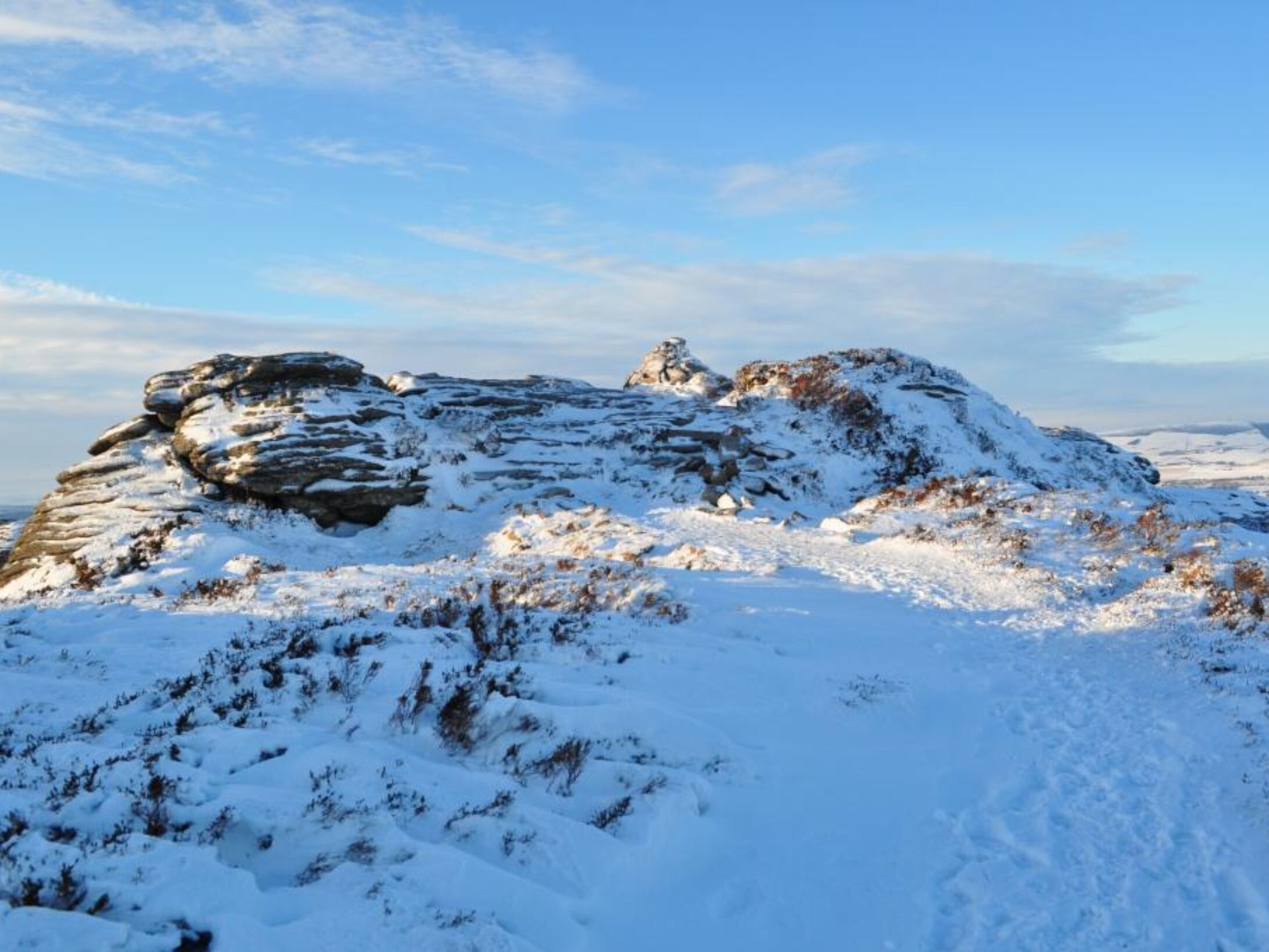
On 12th February 1952 a Gloster Meteor single-seat turbo-jet powered fighter crashed west of Oxen Craig with the loss of its pilot, Pilot Officer Brian Lightfoot. The plane was a Meteor F Mark 8, Serial No. WA882 of No. 222 Squadron, RAF Leuchars. It took off from Leuchars at 9.58am to carry out a low flying and cross-country exercise. The country was covered in snow and there were frequent snow showers. The late Mrs Lottie Marr of the Mill of Tilliefoure saw and heard the plane. At 10.20am she saw on the hill a cloud of black smoke, heard a thud and then a much louder bang. It had exploded on impact scattering wreckage over a large area.
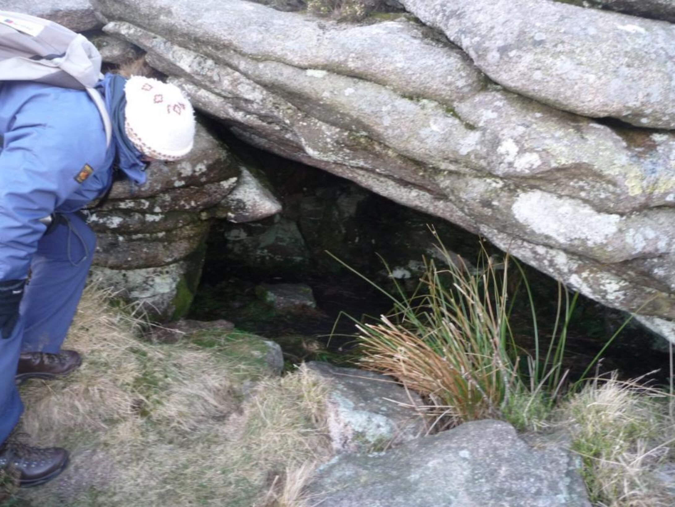
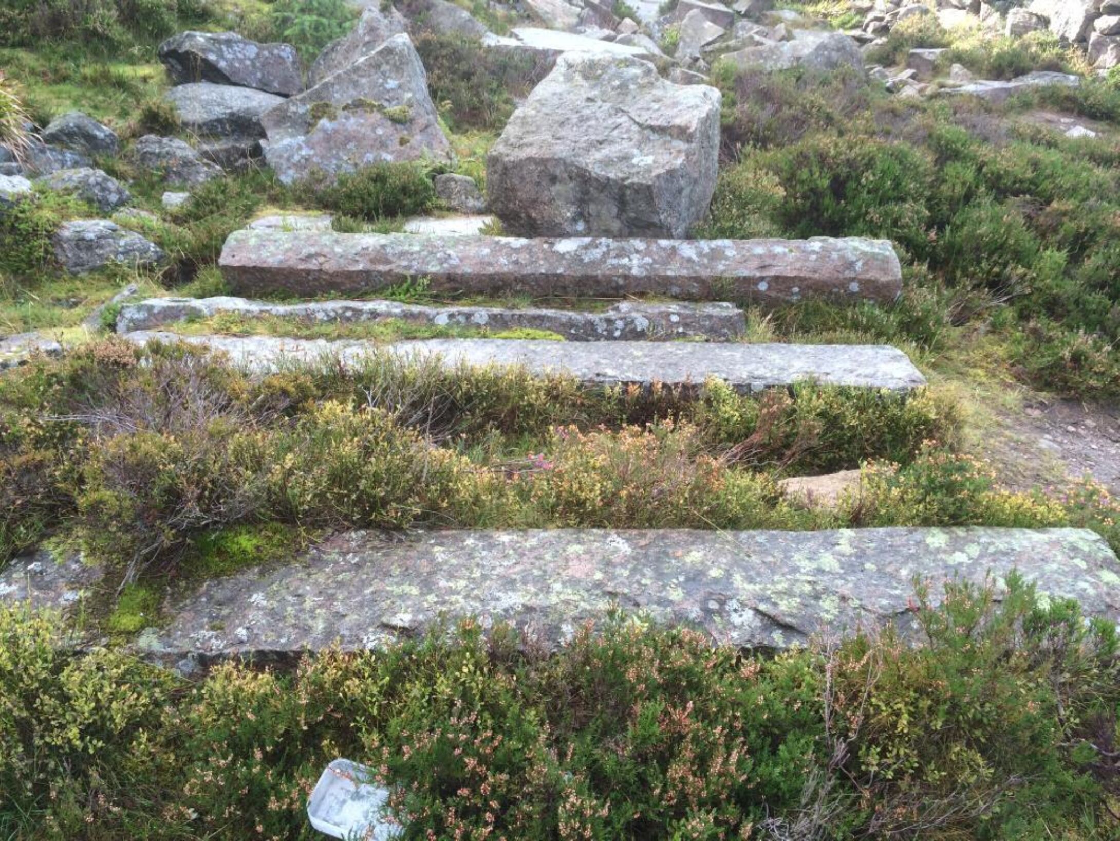
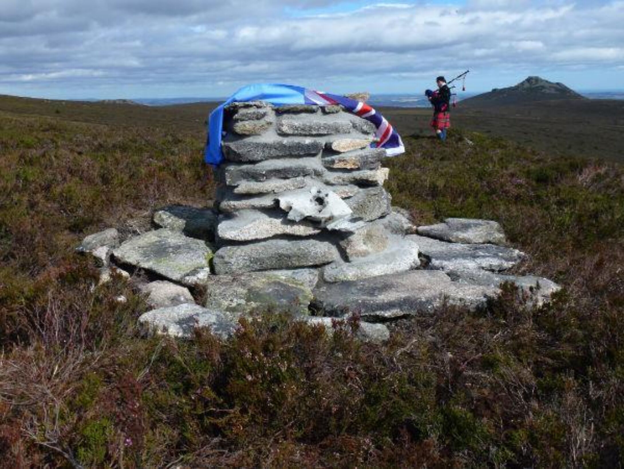
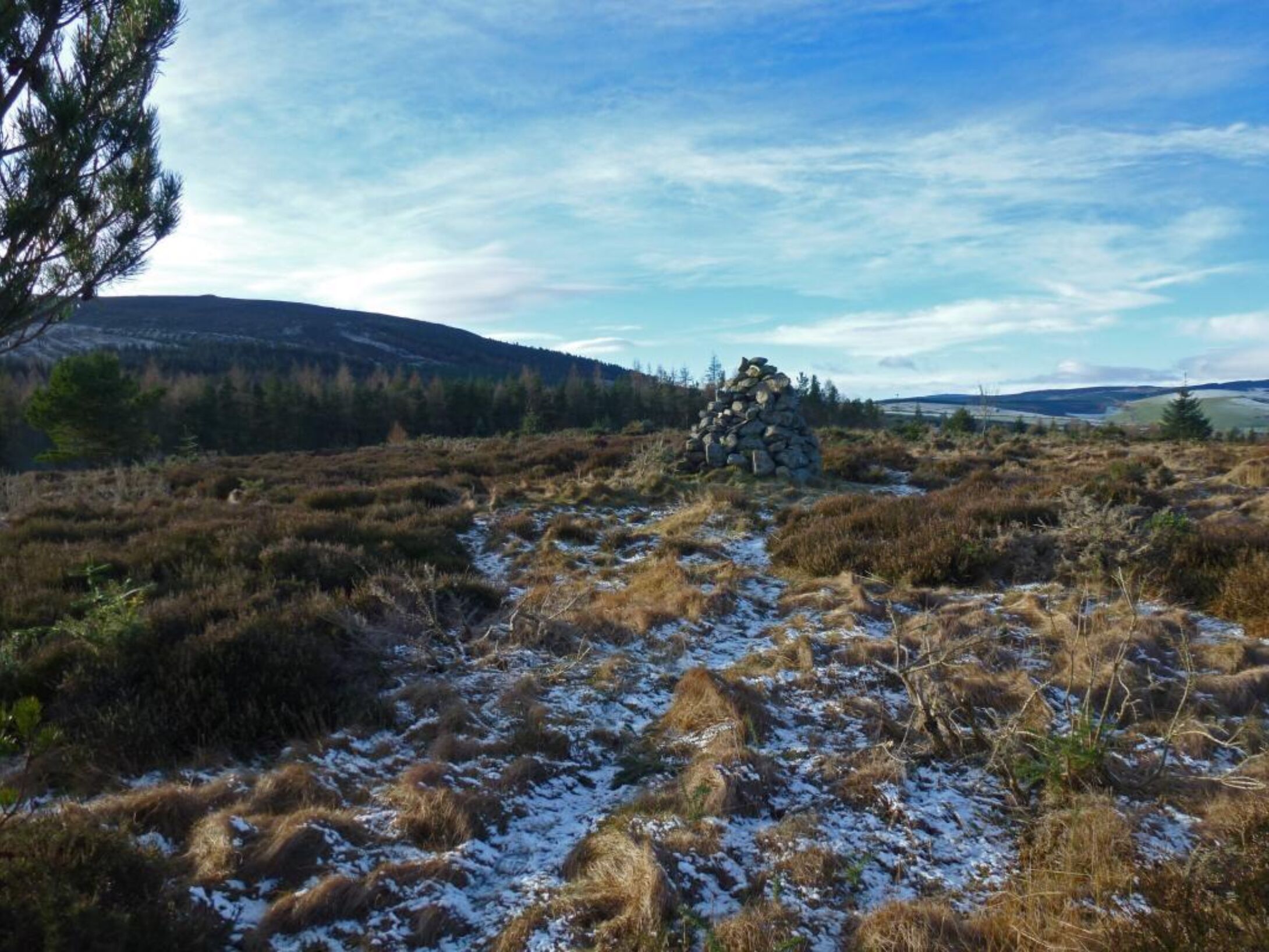
A team of seven airmen from no.44 Maintenance Unit, RAF Edzell, arrived two weeks later to bury the wreckage and spent nine days in cold and wintry conditions on the task. They didn’t find all of it and as in the case of the Wallace it must be left as a memorial to a brave and talented young man. Near the crash site there is a roughly constructed stone cairn with bits of wreckage which must have been erected by the RAF lads as a tribute to the pilot. It is this cairn which has been rebuilt to house the pink granite plaque bearing the name of the three who lost their lives.
The official cause of Brian’s crash was put down to “poor definition of snow covered mountains in the prevailing conditions”.
John Brian Lightfoot was the son of Thomas Monty Lightfoot and Juanita Blakey of Northallerton, Yorkshire, was born on 8th December, 1929. Known as Brian, he was educated locally then went as a boarder to Barnard Castle School from 1942 -1948. In his final year he captained the school swimming team and was Company Sergeant Major for the combined Cadet Force. He won the cross country race called the Barnard Run in 1943 and 1947. He was an officer cadet at Cranwell and was granted a permanent commission on passing out. His father had an ironmongers business, was Chairman of the Northallerton Chamber of Trade and served in the RAF throughout WW II. Brian had no brothers or sisters. His cousin Julie Blakey was involved in the unveiling ceremony at the cairn. At the time of Brian’s death RAF doctors were researching “the stresses and strains of flying in modern aircraft at speeds approaching the speed of sound “ and learning to fly the Meteor to gain first hand experience of the conditions which pilots encounter. Maybe it was the lack of such knowledge that contributed to the crash. In the year Brian died a Meteor was written off every two days and a Meteor pilot was killed every four days.
He was 22 when he died and was buried in a Commonwealth War Grave on 16 February at Leuchars Cemetery with full military honours.
We would ask that people do not remove or disturb any remaining wreckage on the hill but leave it as a memorial to these brave young men.
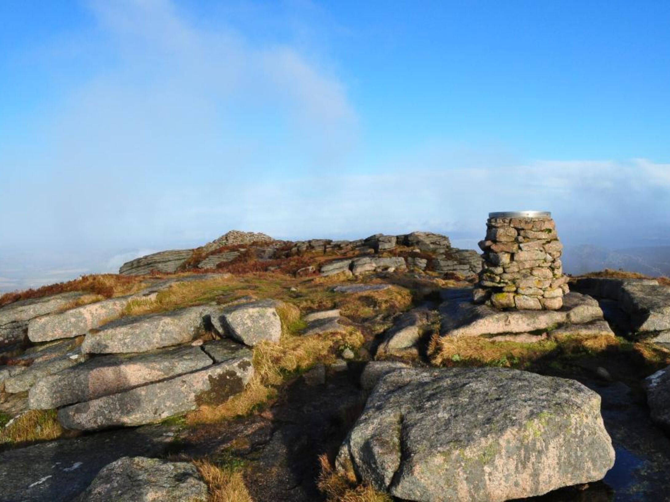
A memorial plaque, commissioned by the Bailies of Bennachie has been built into a cairn on the south side of Oxen Craig to commemorate them.
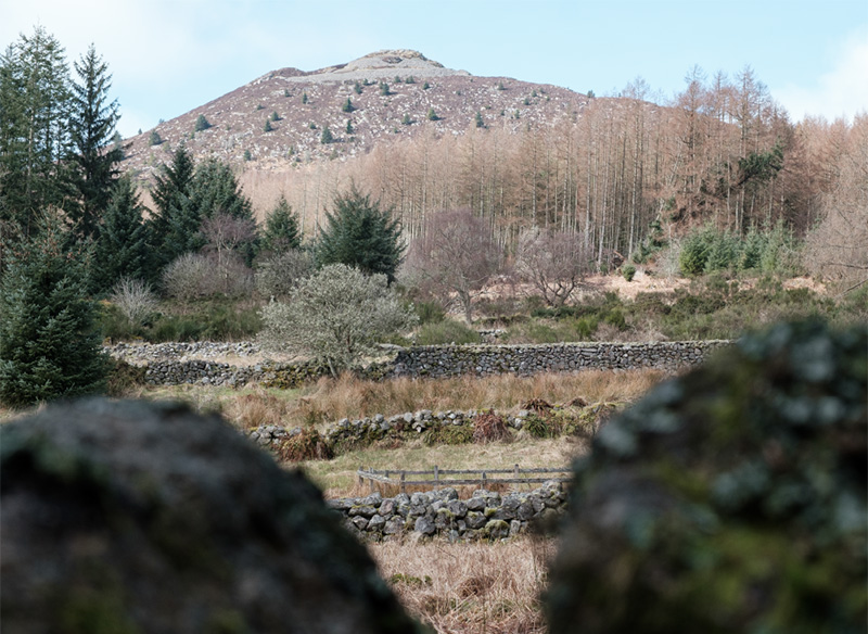
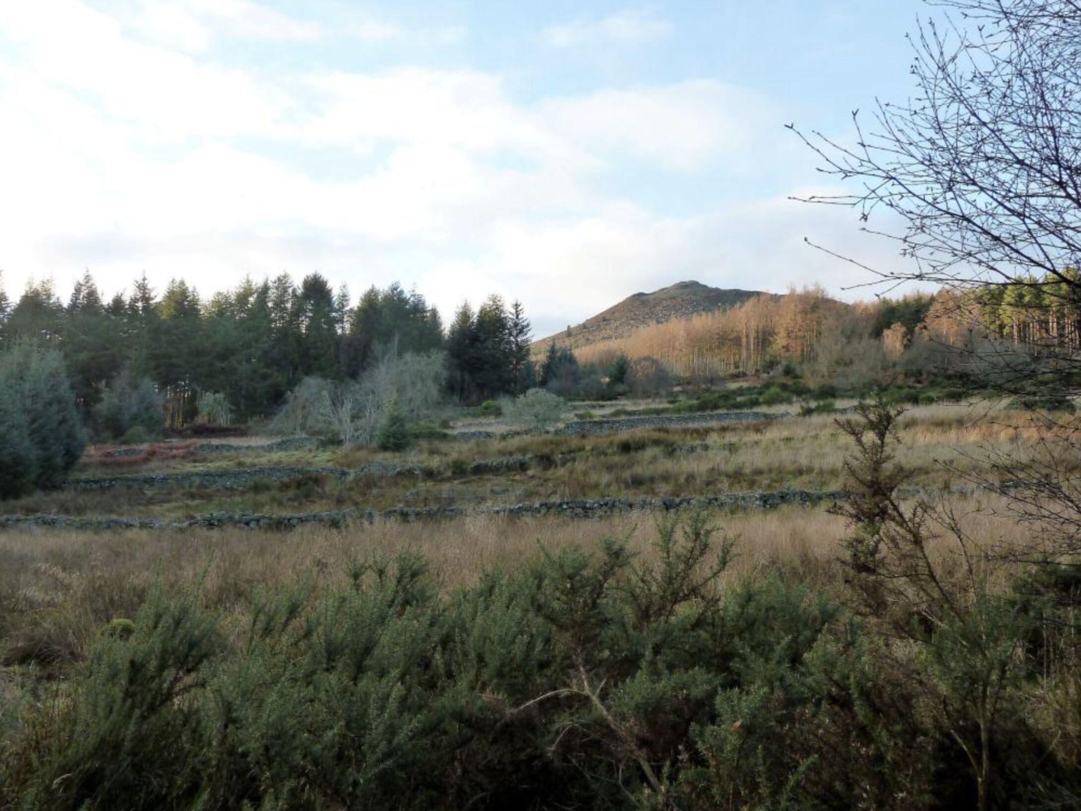
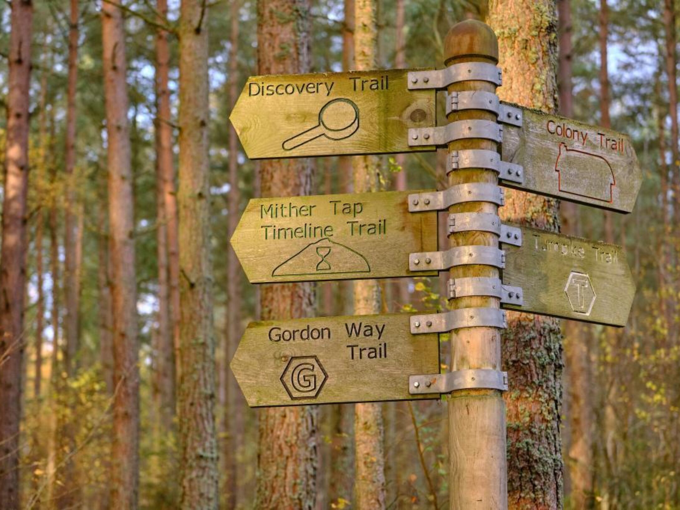
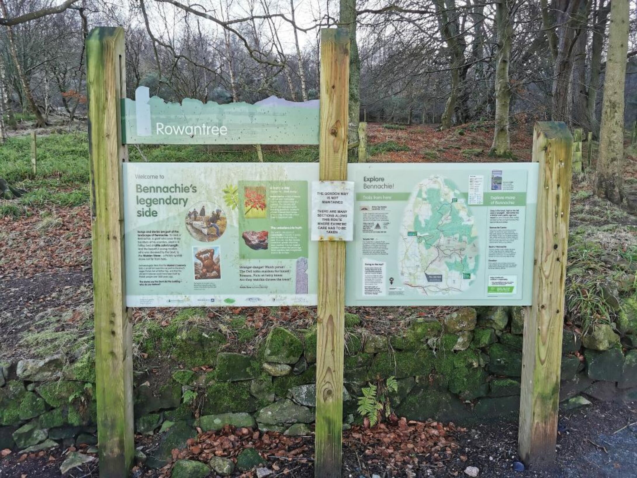
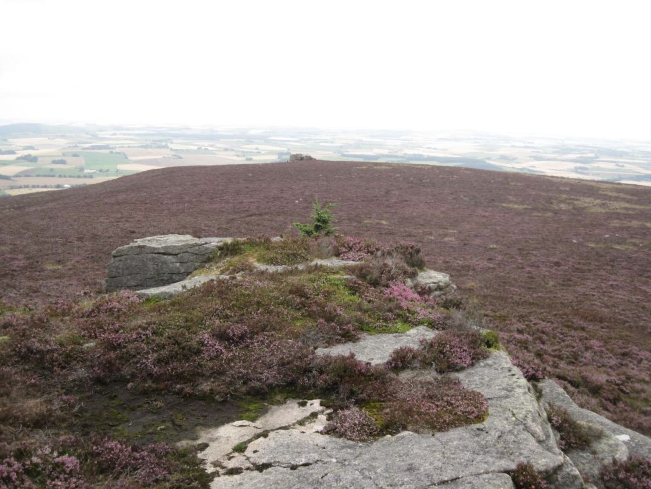
Map Reference: NJ 662 223
Coordinates: (57.290054,-2.5623979)
Maiden Stone
Maiden Stone, Stone with Pictish carvings.
Note this stone is covered in the winter to protect it from the weather.
The Maiden Stone belongs to a slightly later period (around 700–800 AD) and has the symbols standing out in relief. It stands almost 3.5m (11 ft) high and has beautiful art work all over it. On the east side are four panels, the bottom having two figures, a mirror and a comb. The next panel has a representation of an “elephant”; above that a two legged rectangle and Z rod, and at the top four- legged beasts too faint to identify – some think the lower one is a centaur. The west side of the stone has sadly become very difficult to decipher due to the impact of weathering. The lower figure is a pattern of circles and Celtic knot work which is continued in what must have been a fantastically beautiful wicker –work pattern on the sides, this pattern probably being based on the extensive use of willow by early inhabitants in the construction of houses, boats, shields, baskets and so on. Above the circles stands a Celtic cross over 5 ft high, but the detail of the figures above the cross has disappeared.
See also: https://canmore.org.uk/site/18978/chapel-of-garioch-the-maiden-stone
A famous legend probably gave the stone its name. The legend of the lovely Maiden of Drumdurno, tells of a rejected suitor who met the Devil in Pittodrie Woods and in exchange for his soul bought his revenge. It was the eve of her wedding when the maiden was baking oatcakes, singing at her work, when she looked up and there was a handsome stranger who wagered her that he would build a causeway right up to Mither Tap before she had finished baking her firlot of meal. “It sets ye weel to bake lass, gin ye had ony mair speed at it”. Thinking this but idle banter, she lightly promised her hand and heart would be his reward if he won. At twilight, her firlot was nearly all baked, she looked up and saw a causeway finished right up to the hill top and the handsome stranger whom she now recognised as Satan himself, coming to claim his reward. Terror-struck she ran to Pittodrie Woods, but the Devil caught her and as she cried for help, she was turned to a pillar of stone, known to this day as the Maiden Stone. The Mirror and Comb carved on this Pictish sculptured stone were pointed out by the superstitious as the maidens girdle and baking board, and the crack near the top as the mark of Satan’s hand.
Close to Maiden Stone is the Statue of Persephone carved in 1961 by Shaun Crampton.
Also see https://canmore.org.uk/site/274091/statue-of-persephone
Map Reference: NJ 705 246
Coordinates: (57.311013,-2.4913380)
Berry Hill
Berry Hill, Remains of a Prehistoric Enclosure.
One of a series of low hills around the foot of Bennachie, it lies on the north side of the hill rising up from the boggy ground bordering the Gadie Burn, air photographs showed there was a wall that enclosed the top of the hill and there was a stone hut circle on the western slope, at the base of the hill on the north side there are tumbled remains of a 19th century cottage.
For more information see https://ancientmonuments.uk/122251-berry-hillenclosure-600m-south-west-of-bogend-west-garioch-ward#.X6RVSOQTtaQ
Map Reference: NJ 668 252
Coordinates: (57.316147,-2.5528351)
Tillymuick
Tillymuick 254 m, Hill Fort.
This is a hill fort and is the largest enclosed site in North East Scotland. It is situated to the west of the Back O’ Bennachie Car Park. The low rounded summit is enveloped by a stone bank approximate 4m in width and 0.5 m in height. It is difficult to trace the entire circuit but a gap is apparent on the west side and may be the original entrance. Within this stone bank are 8 huts, each 7-8 m in diameter. It is now surrounded by forest and covered with Heather.
For more information see https://canmore.org.uk/site/18212/tillymuick
Map Reference: NJ 649 245 Height: 254 m
Coordinates: (57.309717,-2.5842775)
Newton of Braco
Mither Garth
Mither Garth, Prehistoric Ring-ditch Houses.
This is a group of four well-preserved late prehistoric ring-ditch houses 13 – 17 m in diameter (late Bronze Age or Iron Age) and is less than 1 km south from the Bennachie Centre.
For more information see https://ancientmonuments.uk/126721-mithergarth-ring-ditch-houses-280m-sse-of-west-garioch-ward#.X6RSHOQTtaQ
Map Reference: NJ 700 211
Coordinates: (57.279541,-2.4992113)
Mither Tap Fort
Mither Tap Fort, 518 m, Iron Age Hill Fort.
Mither Tap (or Mother’s Breast) has cliffs of hard wearing granite or tors which mean that it is potentially very dangerous place so be careful especially in a strong wind.
Most people who climb the Tap will approach the final ascent through an entrance corridor in a massive but ruinous wall – the remains of an Iron Age Hill Fort (c. 500 BC-500AD ). There are at least two walls surrounding the summit plus various terraces with signs of dwellings. In 2019 on the west side of Mither tap a well was excavated but is now covered.
For more information see https://canmore.org.uk/site/85507/mither-tap-of-bennachie
Map Reference: NJ 682 224
Coordinates: (57.291097,-2.5292317)
Afforsk Cross Stone
Afforsk Cross Stone. Large Stone with Pictish Cross and Ogham Symbols.
About 40 metres into the forest from the most northerly field of Mains of Afforsk there is an eminence topped with a Bronze Age cairn. At the edge of the cairn there is a stone which attracted the attention of Mike Davidson, a former Clerk to the Bailies of Bennachie. It was covered with moss which he removed and was astonished to find a Pictish incised cross. Archaeologists discovered on its edge a line of Ogham symbols, a primitive form of writing.
For more information see https://canmore.org.uk/site/80727/mains-of-afforsk
Map Reference: NJ 695 208
Coordinates: (57.276814,-2.5074667)
Totem Pole (behind The Bennachie Centre)
This pole was carved by first nation people from British Columbia (Squamish nation) in 2002 as part of Forestry Commission Scotland’s Treefest 2002 celebrations.
The carved pole is a Douglas fir donated by Balmoral Estate. There are three other totem poles that were created in the same year from the same tree, these can be found at Coluqohhine Hotel, Bellabeg, Strathdon and Chapel of Garioch Primary Schools.
Each pole was carved by local people with help from the first nation carvers using local designs and legends.
Map Reference: NJ 697 217
Coordinates: (57.284911,-2.5042605)
Oxen Craig
Oxen Craig 528m, highest point of the Bennachie range, trig point.
This is the highest point of the Bennachie range and a very fine viewpoint. An indicator designed by the Bailies of Bennachie enables you to identify all the visible summits, Clach na Ben, Lochnagar, Morven etc. The summit rocks have small potholes (some people think they are cup marks). Not far from the indicator look for a rectangular hole cut out of the rock. This was the socket of a memorial stone erected by the people of Oyne to commemorate the sad death of a local lad with learning difficulties, Robert Dawson, who went missing from home in November 1856. He was found sitting on this stone 16 days later having died from what we would now call hypothermia. Robbie’s mother, however, objected to the wording on the stone, knocked it down and broke it into pieces.
Map Reference: NJ 663 227
Coordinates: (57.293655,-2.5607937)
Mither Tap
Mither Tap, 518 m, Trig point, info plaque.
Although not the highest point it is the most prominent and spectacular of all the Bennachie tops (the Fujiyama of Aberdeenshire!). The views from the summit are superb. A mountain indicator designed by the Bailies of Bennachie and near to the Ordnance Survey trig point is useful to identify the various landmarks including the high tops of the Cairngorms. Also on the summit carved in a square into the ganite bedrock are the letters “B”, “P”, “LE”, They stand for Balquhain, Pittodrie and Logie Elphinstone, indicating the meeting at the summit of these three estates on the division of the Commonty in 1859 (the lairds must have been confident of the outcome of their case in the Court of Session as the date carved is 1858.
Map Reference: NJ 682 224
Coordinates: (57.291097,-2.5292317)
Millstone Hill
Kewlie Well and Cup and Saucer Stone
Garbit Tap
This is 1 km south of Craigshannoch and has some fine cliff scenery on its south side but there is no proper path to it.
Map Reference: NJ 673 221 Height: 468 m
Coordinates: (57.288338,-2.5441229)
Bennachie Visitor Centre
The Bennachie Centre was opened by Honorary Bailie HRH Prince Charles on 27 April 1995. It interprets both the interesting natural and social history of the hill.
The Centre’s emblem is a cuckoo (see Gouk Stane).
The building was designed by Ronald Reid of the Dodds, Jamieson Partnership after a competition run by Gordon District Council in 1991. It has been designed so that it fits well into the Scots pine woodland that surrounds the centre. The building mimics the Iron Age hill fort found around Mither Tap. You can enter the courtyard at the centre via a drawbridge which aims to remind visitors of the fortresses, castles and battles of the area. The Centre was built by The Bennachie Centre Trust and Gordon District Council with funding from Gordon District Council, Scottish Natural Heritage, Grampian Enterprise Ltd, Forestry Commission, Bailies of Bennachie and European Community. It is managed by the Bennachie Centre Trust but is reliant on Aberdeenshire Council Ranger Service and Wardens for its day to day operation.
Map Reference: NJ 698 216
Coordinates: (57.284019,-2.5025896)
Battle of Harlaw
Map Key
Click a category below to show on the map.